
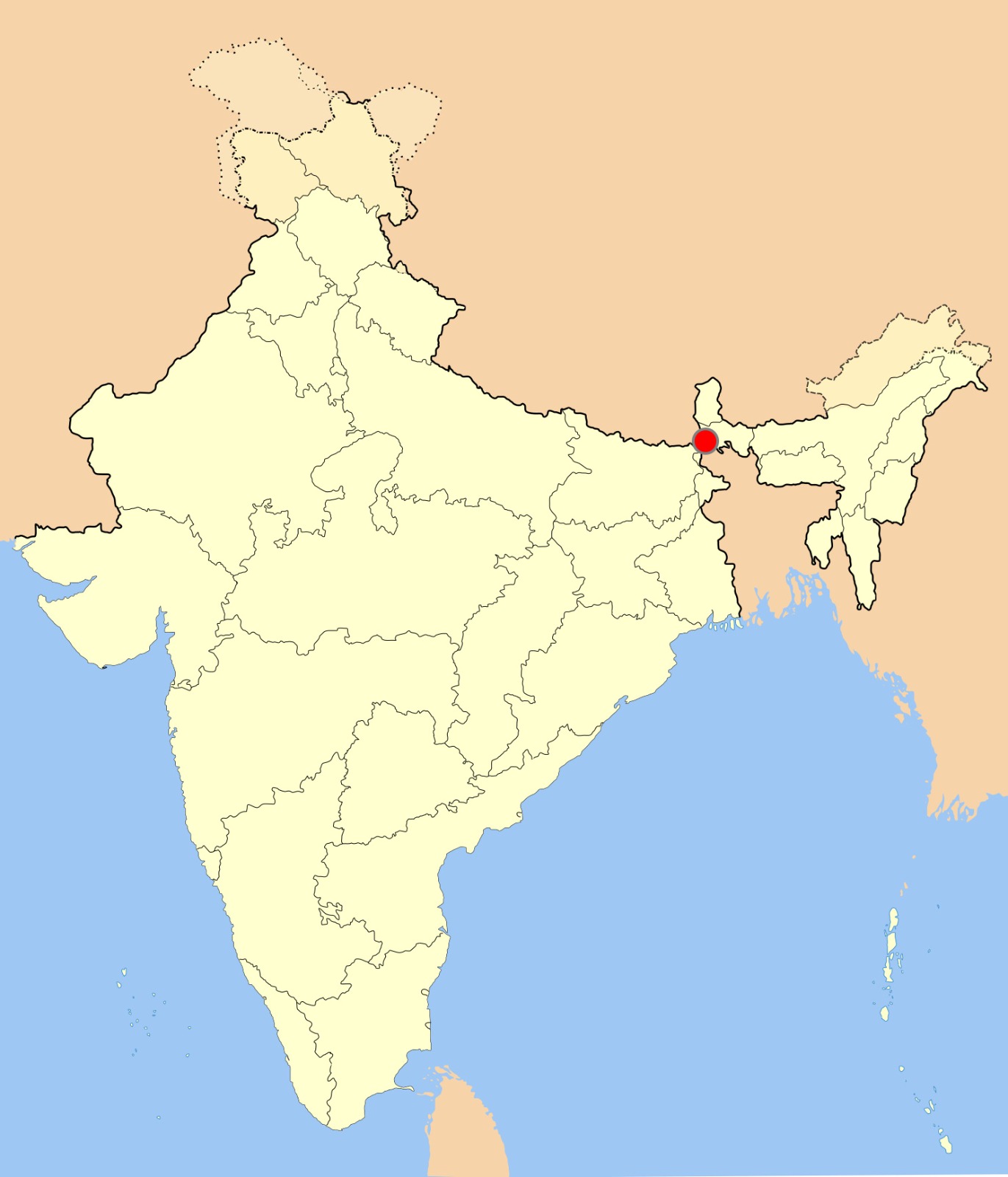
Photo: Siliguri Corridor in India, this SVG map is created by Sbb1413, CC BY 3.0
The Siliguri Corridor, a narrow 22-kilometer strip in northern West Bengal, is the singular land bridge connecting mainland India to its eight northeastern states that is why it is also known as Chicken’s neck. For the 50 million citizens residing in the Northeast, this corridor is an irreplaceable logistical and economic artery.
Recently, this region witnessed an unprecedented scale of military fortification, accompanied by the rapid deployment of Central forces.
Reality of a Geographic Chokepoint
The vulnerability of the Siliguri Corridor is not a new political talking point; it is a hard geographic fact. Measuring just 22 kilometers at its narrowest, this small strip of land has always been a complex ‘Chicken’s Neck’ to manage. Because it sits incredibly close to several international borders, local authorities and the Border Security Force (BSF) have spent decades dealing with everyday, ground-level challenges like cross-border smuggling and unauthorized immigration.
However, these routine border policing issues do not explain the massive transformation happening on the ground today.
The sudden arrival of advanced missile defense systems and the construction of deep, underground military train routes signal a complete shift in how India views this region. The government does not build multi-billion-dollar subterranean bunkers to manage localized unrest or track smugglers. These heavy-duty infrastructure projects make one thing clear: defense strategists are no longer treating the Chicken’s Neck as a local policing headache. Instead, they are actively armor-plating the corridor against the threat of a full-scale, state-sponsored military conflict.
Constitutional Stagnation
While the corridor desperately needed these defenses, the delay was caused by a constitutional tug-of-war, not a deliberate compromise of national security.
Under Schedule 7 of the Indian Constitution, matters relating to “Land” and “Public Order” fall exclusively under the jurisdiction of the State government. Central agencies, including the Ministry of Defence, cannot unilaterally acquire private land for military bases or transfer the administration of state highways without the explicit legal approval of the state cabinet.
The previous West Bengal administration operated under a firm political mandate against the forced acquisition of land for government projects. Consequently, essential No Objection Certificates (NOCs) for defense infrastructure were frequently withheld. This friction peaked in 2021 when the Centre extended the BSF’s operational jurisdiction from 15 kilometers to 50 kilometers, a move the state challenged as an infringement on its federal autonomy, resulting in bureaucratic paralysis.
In May 2026, with the BJP forming the government in West Bengal, this constitutional stagnation dissolved. Because the same party now governs both the State and the Centre, the new cabinet rapidly approved the pending land acquisition files, granting the military the legal authority to proceed with its modernization.
360-Degree Vulnerability: Navigating China, Bangladesh, and Nepal
The Northern Front (China): The most severe conventional threat originates from the Chumbi Valley, a heavily militarized Chinese territory situated just 130 kilometers north, nestled between Sikkim and Bhutan. From this vantage point, long-range Chinese artillery could effectively target the corridor’s transport links. This vulnerability triggered the 2017 Doklam standoff, where Indian forces intervened to prevent China from constructing infrastructure toward the Jampheri Ridge, which would have provided a direct line of sight over the Siliguri Corridor. Furthermore, the corridor’s logistical fragility was demonstrated internally during the 104-day Gorkhaland strike in 2017, which paralyzed National Highway 10. Defense planners recognize that if a localized civil strike could sever supply lines, a targeted military strike would be catastrophic.
The Southern Boundary (Bangladesh): To the south, the porous nature of the Indo-Bangladesh border presents distinct security challenges. Intelligence agencies consistently monitor transnational radical outfits, such as the Jamaat-ul-Mujahideen Bangladesh (JMB), which exploit the complex riverine borders to establish operations within Indian border districts. Securing the region requires hardening this boundary against organized cross-border militancy.
The Western Border (Nepal): The western border with Nepal operates under the 1950 Indo-Nepal Treaty of Peace and Friendship, permitting the free movement of citizens. While economically vital, this open boundary is increasingly utilized by human trafficking and contraband syndicates. Coupled with Kathmandu’s occasionally shifting diplomatic leanings toward Beijing, Indian defense strategists are reassessing the long-term security protocols of this frontier.
Strategic Infrastructure Transformation
Operating with full legal clearance, the Central government has now launched a comprehensive, multi-pronged overhaul to ensure the corridor’s absolute survivability.
The immediate first step was the formal handover of critical surface routes, including NH-31, NH-33, and the highly vulnerable NH-10, to the National Highways Authority of India (NHAI). These arterial roads are currently undergoing rapid, military-grade widening to support the uninterrupted movement of heavy armored regiments and advanced missile defense systems.
To bypass the fragility of surface roads entirely, the government has commenced construction on a 40-kilometer underground military railway tunnel between Tin Mile Haat and Rangapani. Engineered deep below the surface, this subterranean transit route ensures that vital troop deployments and supply chains to the Northeast can continue safely, even under the threat of heavy aerial or artillery bombardment. Accompanied by the activation of new forward operating bases in the surrounding districts, the Siliguri Corridor is systematically being transformed from a vulnerable national chokepoint into a highly resilient, heavily fortified transit hub.